Thursday 30 June 2016

Västervik

Before we left Figeholm we bought fresh bread and pastries from the traditional baker's shop which opened at 7am. The whole  day has been spent following narrow channels and threading between rocky islands working northwards up the East coast. There are so many small islands that the waves of the open sea get damped down so the waters are quite calm and only the outermost islands get exposed to any wave action.
The picture shows a very narrow channel between the islands of Grono and Spono with Calismarde following in Bonita's wake.

Unfortunately we found that Calismarde has been leaking, and we decided that she needs to be pulled out of the water for a proper inspection before returning home. So we have come to Västervik where there seem to be plenty of opportunity to get things fixed.  

Plots below show today's complex network of islands and our overall Swedish progress:


Tuesday 28 June 2016

Among the islands - Figeholm

Today we had sun and light winds. We left Sandvik and after about 3 hours passed close to Blå Jungfrun (the Blue Virgin). This is an isolated rocky island which is now a nature reserve.   The rocks here clearly show the effects of the glaciers which moulded much of this area until the end of the ice age about eleven thousand years ago.

After another couple of hours we entered an area of intricate channels among the rocky islands. This sort of sailing can be unsettling to a yachtsman used to more open waters. The passages between the rocks are narrow, tortuous and require a lot of concentration to sort out the intricate navigation.

We anchored in a gap between the rocks and after lunch went ashore to one of the islands. It was uninhabited, but there were some derelict buildings with the remains of dinghies, small boat equipment  and various toys. It had clearly been a family summer house at some time, but perhaps fallen into disuse when the children grew up.
We then went to Figeholm, a small village at the top of the fjord. After mooring the boats we visited the Maritime museum. The photo shows Tim, Hugh, Julia and Geoff admiring a collection of old outboard motors.

We had a barbecue with Björn, a German who is sailing these waters single handed. Getting even a modern yacht in and out of these small harbours can be difficult enough and we admired the skills of someone who can do this on his own.
The final picture shows a still evening at Figeholm.

Monday 27 June 2016

Sandvik

We had a sunny fair wind sail from Kalmar today. While Kalmar is a city, Sandvik, on the island of Öland is just a collection of a few houses around a small harbour. The main industry here is limestone quarrying and the harbour was originally built to serve this trade. Before the harbour was built in the 1870s the trading ships used to anchor off the beach. Limestone blocks for export were loaded into rowing boats and then taken out to the waiting ships. There are no longer any commercial ships using the harbour now which is mostly used by yachts.

Visiting yachts use the box mooring system which is quite common in this area. The boat is moored bow or stern against the quay, and the other end is moored to a buoy out in the harbour. This means you have to get a rope on the buoy as you approach the quay, then rapidly come to halt close enough for your crew to get a line ashore without actually hitting the dock side. When, as was the case today, there is a brisk cross wind, this procedure requires a degree of power and maneuverability that we do not possess.
I avoid this type of mooring berth in harbours whenever possible if there is a choice, but sometimes like today there is no alternative. Fortunately there were lots of people around who were happy to help by pulling on ropes, giving advice, etc.  The only consolation is that some owners of more modern boats seem to have as much difficulty as we did.

The windmill at Sandvik was built in Dutch style in 1885, but has now been converted to a restaurant:


Sunday 26 June 2016

Kalmar Day 2

Kalmar is a good place to change crew with the railway station right next to the harbour. We spent today here as Calismarde is having a crew change: Lawrence sadly had to return home and Hugh and Julia are coming out.  We spent the morning doing assorted odd jobs such as visiting the launderette and touching up chipped paintwork. Its important to have a rest day occasionally to get these things done.

In the afternoon we visited Kalmar castle. This is an imposing castle with a fine position overlooking the harbour and the sound between the mainland and the island of Öland.

The castle was originally built in the 13th century. It was greatly improved and expanded in the sixteenth century when it became a royal palace, and to a large extent this is the state in which it has been preserved. Kalmar has always been an important trading port especially for trade with Germany. For many years the Danes occupied southern Sweden so Kalmar Castle was close to the border. Its political importance declined after the 17th century due to boundary changes, and it was used for more humble purposes, such as a distillery and a prison.
The castle has some spectacular internal decorative woodwork and several rooms have been restored to the state they would have been in during the castles period of importance. There are examples of period furniture and reproductions of the clothes the noblemen wore.  There are also some sobering exhibits from the time the castle was used as a women's prison.

The castle stands in parkland containing some contemporary artworks which invite questions rather than explanations. This third photo shows Tim investigating one of the installations.

Kalmar

We left Bergkvara in light winds, passing through a rocky channel that seemed hardly to be wide enough for the boat.

Today was the day when we came to the edge of the known world on our GPS chart plotter. As with Christopher Columbus, everything after this was unknown territory. The reason was due to confusion on my part when buying a chip for the plotter to cover the Baltic. Normally our plotter covers waters as far as the river Elbe so I bought an extra chip to extend it. I thought I was buying a chip that would take us all the way up to Stockholm, but it must have been for a smaller area as we sailed off the edge a few miles outside Bergkvara. Sometimes you can't be sure what you are getting when buying on the internet. Fortunately we have all the charts of this area and have been navigating in traditional fashion by making pencil marks on paper charts.

Navigation is generally fairly straightforward as there are plenty of good navigational marks. This lighthouse in fetching peppermint green is known as Skansgrundet. The names of places and lighthouses here are often extraordinary. Furthermore the names as written seem to bear no relationship to the pronunciation used by native speakers so there's no need to spend time trying to memorise them.

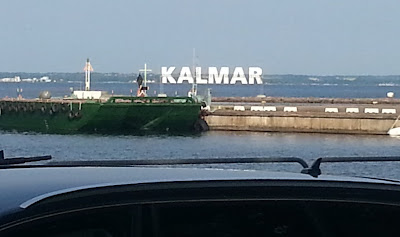
We are now in Kalmar, which is a large port city with many historical features. We will probably be here for a day or two as Geoff is changing crew.


Saturday 25 June 2016

Bergkvara

Bonita is, for the present, still in the EU, in Eastern Swedish waters.
Karlskrona is ringed round with dozens of rocky islands which must add to the complexity of defending it as a naval base.  No doubt every ship movement, including those of slow moving old gaffers, is noted somewhere. A few years ago a Soviet submarine ran aground on these rocks while engaged in an unspecified activity. This created some political excitement at the time. Presumably we only hear about these episodes when something has gone very wrong.
Bergkvara harbour's very narrow entrance

We spent this morning threading around many rocky islands as we left Karlskrona. The channels are intricate and surrounded with rocks but well marked with buoys. This would not be a good place to be lost in fog or on a dark night. Some of the islands are nature reserves but many have holiday homes on them: sometimes just a single house and a quay on a tree covered piece of rock.

We had a light weather sail and are now in the very small harbour of Bergkvara, a few miles further up the coast.

Thursday 23 June 2016

Karlskrona

While we have been hearing distressing stories of thunderstorms, flooding and referendum hysteria at home, we have been enjoying more summery weather. The first picture shows a few of the very many sparrows on Hanö enjoying some crumbs from a digestive biscuit on Bonita's deck. Note that the sea is completely calm. 

We started out this morning under motor but later a reasonable breeze came up. We threaded a complicated but well marked channel through many rocky islands and  we are now at Karlskrona.  It is the principal base for the Swedish navy and there are old defensive forts on many of the outlying islands.  
There are some fine public buildings dating from the mid eighteenth century, and a maritime museum (pictured) with exhibits both ashore and afloat.

There is much celebration of midsummer and even quite humble boats are decked out with vegetation as their owners take off to small outlying islands for the night to mark the occasion in suitable style.  

In the city several streets have been closed to traffic and there are crowds of people enjoying the stalls and various entertainments.  All the bars and restaurants are full but we managed to get a meal near the harbour.

Wednesday 22 June 2016

Hanö

Today is midsummer. At least it is everywhere in the northern hemisphere except Sweden. It seems that the Swedes celebrate midsummer's night with such enthusiasm that little work is likely to get done the next day. Therefore in Sweden it has been decided that midsummer this year will be on Friday.
Disregarding this technicality, we had a genuine summer's day, warm with blue skies. We had a 30 miles sail to the harbour on the small island of Hanö. The first picture shows Bonita and Calismarde tied up to the quay of this miniature harbour.

This island  is virtually the beginning of the Swedish archipelago which consists of over 24,000 islands and stretches right up the east coast.  There is much of interest here although there are only 60 permanent residents and we were reliably told that 'nothing' happens in the winter.
We walked over the island which is mostly granite which has been moulded by the glaciers of the last ice age. The Royal Navy had a base here during the Napoleonic wars and there is a cemetery containing the remains of British sailors who died here in 1810-12. 

There are open air sculptures, artworks and installations that appear unexpectedly as you walk around the island: the third picture shows a steel raven and the fourth a tree of hearts. There are large numbers  of real birds too, perhaps helped by the fact that the island is too rocky to support  agriculture.
We had a swim in the Baltic, which is noticeably less salty this far from the open sea, and a barbecue on the quay as part of our own celebration of midsummer.


Tuesday 21 June 2016

Simrishamn

We looked around Ystadt this morning and as it was a bit wet and blustery we were uncertain about leaving harbour. However we were glad we did because after a bit of rough water in the harbour entrance we had a fine sail. The rain stopped, the sun came out and though the wind was a bit squally the boats were going well. By about 4pm we got to the little fishing town of Simrishamn, so now we are in Eastern Sweden.
It is beginning to seem a long way from home.

Every harbour you go to here the harbourmaster gives you a coloured sticker to put in the rigging to show you've paid. I hadn't come across this before but we collected our first coloured payment sticker in Terschelling and we now have quite a collection in the mizzen rigging. We should have quite a lot eventually.

We explored Simrishamn which seems a lively little town. It has a fine solidly built church, dating from 1161 and subsequently extended several times. Among the decorations there are a couple of high quality models of sailing ships suspended from the roof. We have seen this in Danish churches as well: these are nineteenth century votive ships, and were presented to the church by local fishermen and ship owners.

Monday 20 June 2016

Ystad

Bonita has now left the Eurozone and this evening is floating peacefully in Swedish waters.
We left Mon as soon as we could, having filled up with diesel and visited the local shop. Initially Tim and I had a fair wind sail and the first picture shows us passing the chalk cliffs at the east end of the island of Mon. These come as rather unexpected as most of Denmark we have seen so far consists of low lying sandy islands. You can see the white cliffs of Mon from more than twenty miles away.

There was a small cluster of boats going from Klintholm to southern Sweden. Our fair wind petered out after a few hours but then we had a reasonable SE breeze and we covered the 50 miles to Ystad in about 10 hours. The picture below shows us tied up in Ystad alongside Westhinder. She is a large and very impressive aluminium yacht, built 3 years ago and sailed by an elderly husband and wife team.


It is noticeable that far fewer people take an interest in old boats here than in either Britain or Holland. There we were always being asked how old she is and details of her history. That doesn't seem to happen so much in Danish or Swedish waters. Maybe they don't have so much of a culture of old boats, or maybe they are just too polite to ask why we are living in such cramped and unsatisfactory circumstances.
It is quite windy tonight but there is satisfaction in being safe in a snug harbour when it is a bit wild outside.

Below is a brief but very clear film of Bonita sailing beautifully this afternoon:
If you have problems with the link above, it is also available on YouTube by clicking here.

As usual, here is our day's track, also showing Calismarde.  The straight lines show where we are out of range of the Internet - the track resuming once we're nearer the shore:


Klintholm Havn

There was a fresh breeze this morning and we had to help Bonita out of Vejrø harbour with ropes, but after that we had a fine mostly downwind sail between the Danish islands. Sometimes there are quite intricate channels between the islands needing careful navigation. We passed under two high level bridges joining the islands. The picture shows Calismarde approaching a bridge with 26m clearance.

Although there are no tides in the Baltic, there are currents caused by the wind, and these seem difficult to predict. Although erratic presumably it must be these currents that keep the channels free of siltation and prevent the whole area becoming one large shallow sandy lake.
The Danish charts are very good but the topmarks to their buoys are sometimes difficult to make out from a distance. The topmarks are often brushes rather than a solid structure: presumably this discourages birds from perching on the buoy and turning black into white. However these outsize brushes often get deformed and are sometimes missing altogether which can be confusing.

This afternoon we came into the small harbour of Klintholm on the island of Mon. There was a strong onshore wind and the entrance was quite narrow so coming in needed a fair bit of concentration. As so often happens, the waves reflecting from the harbour walls made the sea rougher and more confused in the harbour entrance than further out at sea, which can sometimes be dangerous.
This harbour is at the SE corner of Denmark, and there are several Polish yachts here, which I do not remember seeing at previous ports we have visited.

Sunday 19 June 2016

Vejrø

Lawrence came this morning on the bus from Copenhagen to help crew Calismarde. It was still quite windy in Bagenkop harbour, but we decided to leave anyway. After a bit of bouncing around outside the harbour entrance we had a fine downwind sail in bright sunshine. By late afternoon we were weaving around the sandbanks surrounding the small Danish island of Vejrø with its miniature harbour.

This is a peaceful place. There is a bit of agriculture, and there has been some investment in facilities to attract campers and yachtsmen. However there seem to be very few people here and there was plenty of space in the harbour​, so we suspect their busy season is probably fairly short. We had a remarkably good meal in the only restaurant​ - fresh food from the island - f​ish soup, lamb and strawberry panna ​cotta.

​Vejrø is a nice place to visit especially if you are looking for peace and relaxation, but not somewhere to be stuck for any length of time.


Saturday 18 June 2016

Langeland - in Danish waters

We left the British Kiel Yacht Club this morning and motored out in very light winds. We passed lots of warships of many nations coming up the Fjord for Kiel week.This is obviously a very significant occasion for showing the flag and making formal and informal contacts, in addition to any sporting activity.

We could not identify any Royal Navy vessels but as we passed, Bonita was saluted by about sixty crewmembers lining the rail of a large American warship. It may be that this was a tribute to her - but more likely they were practicing simultaneous saluting by numbers in preparation for the formalities to come.
After a few hours of moderately foggy weather we got to Bagenkop, a small fishing port on the Danish island of Langeland. This is more of a village than a town with lots of neat red and white houses. The Danish currency is the Kroner, but we have none and there are no banks or cash dispensers for miles so the shops take Euros anyway.

The first picture shows Bonita and Calismarde against the background of the town. Both boats are flying their Danish courtesy flags.

The British are sometimes proud of the bold design and the long tradition invested in the Union Jack, but the Danish national flag (the Dannebrog) is much older than ours. According to legend it came down from heaven to encourage the Danes when things were going badly in a battle with a neighbouring tribe in 1219. They did better after receiving this encouragement.

We are here waiting for more crew for Calismarde, but this evening a strong wind came up with spray blowing over the harbour wall. So we may have time  to get to know Bagenkop quite well.

Kieler Förde

This morning at Rendsburg Steve had to leave us. He has been a tremendous help on both boats since the start of the cruise. We then motored in calm weather the remaining 30km to Kiel to lock out into the Baltic. The photograph shows Bonita in one of the huge locks at the end of the canal, in much the same position as my little boat Asphodel many years ago.

Tim was coming to join us and we had arranged to meet him at the British Kiel Yacht Club, about a mile from the canal entrance.  This club is run by the armed services to provide a sailing club and sail training for the British armed forces, although anyone can use their mooring facilities.  This is very much an island of Britain in Germany, and a curious relic of the days of the cold war when we had many servicemen stationed here.  We were fascinated to see this quaint institution, and as so often, the British abroad can appear more British than those at home.  Sadly the British Kiel Yacht Club is now considered unnecessary and it is being closed at the end of this summer.

This is Kiel week, a major yachting event with many visitors  and in some marinas it can be difficult to find a berth.  In the Yacht Club there were two immaculate 12 metre racing boats. Nearest the camera is Thea, built in 1918 but much altered since.  Beyond her is Vim, built in the US in 1938 to defend the Americas Cup.
Thea and Vim


Thursday 16 June 2016

Kiel Canal Part Two

We spent the night at Brunsbüttel, at the western end of the Kiel canal. All night long, huge ships were being very gently and slowly guided into the locks only a few yards away from us. We woke to a still foggy morning. However the fog cleared and we had a bright sunny day as we motored along the broad tree-lined canal.  Calismarde is here shown motoring past a might container ship.

The second picture shows the paddle steamer Freya which passed us at great speed carrying a cargo of tourists. Built in 1905 she was originally a royal yacht. Paddle steamers are inherently inefficient and we were surprised by how fast she was going. It turns out that she has had an  additional propeller propulsion system retro-fitted to perk up her performance.

The Kiel canal is almost 100km long and when opened in 1895 was viewed as a substantial engineering and financial achievement of the new industrialised Germany. Seen as it is now, running through gentle farmland and useful for commerce and tourism, it is hard to see the canal as part of the arms race that lead to the first world war. Yet it was constructed to allow battleships to pass unhindered from the German Baltic ports to the North Sea. A war with Germany was often anticipated in the early years of the twentieth century. There was open discussion in Britain that if a war was to come, then it was unlikely that it would start until the Canal had been widened to accommodate larger battleships and increased naval traffic: this work was completed in 1913.

Tonight we are at the delightful town of Rendsburg, about 2/3 of the way along the Kiel canal. Our experience was not spoilt by the fact that a torrential rain squall started just as we were tying up the boats. Here we filled up with diesel and found a suitable restaurant in the quaint town centre.

Wednesday 15 June 2016

Kiel Canal Part One

This evening Bonita is floating in the peaceful waters of the Kiel canal.

The passage from Norderney can be difficult as there is the uncertainty about the weather but it is important to get to the entrance to the Elbe at low tide. The tides in the Elbe are quite strong so it matters about getting the timing right. Today we had light winds and motor-sailed much of the way. However the tides worked out quite well. Starting at 5am from Norderney we covered 80 miles in daylight, which is fairly good going.

Steve and Kugelbake
The picture shows Steve, dressed appropriately for the day's weather,  in front of the Kugelbake,
which is an ancient navigational mark at Cuxhaven at the mouth of the Elbe. The Elbe runs up to Hamburg and is very busy with shipping - much busier than the Thames. We have come 40 miles up the Elbe to Brunsbuttel, which is where the river is joined by the Kiel canal.

Asphodel in 1973

This trip has bought back memories of my first trip to the Baltic, made in a 15 foot long grp boat called Asphodel in 1973. This was a Sunspot, designed and built in a shed in Brixton by Arthur Howard. Drawing less than 2 feet she was ideal for sailing over the sands inside the Frisian islands. The challenges of sailing a boat of this type were quite different from those of sailing Bonita. The second photo shows Asphodel in the foreground negotiating one of the huge locks in the Kiel canal; the crew, complete with 70's hair and flared jeans, is the especially long-suffering and tremendously patient Marc Harris.

Monday 13 June 2016

Norderney

There were light winds today so we mostly motored from Borkum to the island of Norderney. The heavy swell from the north seems to have settled after a few days of quieter weather. We saw several porpoises - or maybe they were dolphins; they look very similar in the water except that dolphins are larger, which doesn't help much if you don't see them together. We had a torrential rain shower which blotted out visibility just as we were coming into Norderney harbour but otherwise all was fairly straightforward.

Norderney is a long established and sophisticated resort. There are plenty of serious yachts here including a collection of very thirsty looking racing powerboats. We have now become quite used to being the only British yachts in the harbour.

Sunday 12 June 2016

In Borkum

When the bridges opened this morning we soon got to Delfzijl. This is a busy industrial port, and the picture shows D with one of two huge floating docks that were in the harbour. We were later joined by Calismarde which had been waiting at Borkum for a couple of days. 

D had to leave to go back to more important but perhaps less exciting work at home and took the train to Amsterdam. Steve jumped ship from Calismarde and is now enrolled on Bonita's crew list. After D had left us we sailed down the river Ems to the German island of Borkum. 

The Ems is quite heavily industrialised but Borkum is primarily a tourist resort.  The second picture shows our two boats in Borkum complete with brand new German courtesy flags.

Calismarde took the outside route to Borkum while Bonita went inland:


Saturday 11 June 2016

Back in fresh water


We decided to try out the repaired engine in fresh water so today we motored through the canal system in the direction of Delfzijl on the river Ems.

I had not previously been on the canals of north Holland, and they are much quieter than the ones on the 'fixed mast route' further south. There is much less commercial traffic and they are in general much more peaceful.
The picture shows a genuine working windmill complete with canvas sails. When we took the picture it was slowly turning in a gentle breeze. Today's windmills seem to be referred to as wind turbines, but the Dutch got there first. Usually their purpose was to pump water from the low lying fields up into the canals, whereas in England they mostly were genuine mills, grinding corn.

After several miles of gentle motoring through fields and farmland we got to Groningen by early afternoon. The canals here are a bit more hectic as there are lots of bridges and some fairly unmanoeuvrable craft trying to negotiate them. Bonita had to go  through one bridge backwards in reverse gear. On another occasion we were busy doing a 3 point turn in the middle of a canal when a tourist boat full of passengers came up close to see what all the fuss was about. D had to fend off the tourist boat with a boathook to prevent damage to both boats. The skipper of the tourist boat seemed quite unconcerned but there was plenty of interest from his passengers who gave D a round of applause.

The bridges mostly stop opening after 8pm so we came to a halt at a bridge about 4 miles short of Delfzijl. We  spent the night securely tied up just off the main canal.

Friday 10 June 2016

A Difficult Day

We left Lauwersoog at first light to get the tide out over the bar.  We had a good tide under us but when we got out towards the open sea we found a heavy swell coming in.  This was quite lumpy but not too much of a problem in itself until, at just about the shallowest point of the bar, the engine stopped.  It later turned out this was due to a fuel pump failure.

Without an engine we were then in a very difficult situation with little wind and a strong tide sweeping us sideways onto the sands. We dropped the anchor and 30m of chain in 3m of water.  We put out a Mayday call which was relayed on by Geoff who was following in Calismarde.  Things were uncomfortable  while waiting for the lifeboat with big rolling waves bursting right over the boat.  Doing anything was difficult, and everything soon became very wet. 

After about 20 or 30 minutes a large black  Dutch lifeboat appeared and was handled excellently in difficult conditions.  They passed us a line with great skill as both boats were rolling about on the waves.  The force on Bonita's anchor chain was such that it was quite impossible to recover it so once the towline was secured   I cut the lashing at the end of the chain and let it go.  We were towed back the way we had come and were soon once again tied up at a pontoon at Lauwersoog.  The picture shows our lifeboat tow once we were back in smooth water.   We cannot speak too highly of the skill and seamanship of the Dutch lifeboatmen who, like ours, are unpaid volunteers.
Poor Bonita was wet throughout with quite a lot of minor damage and scuffed paint. Lauwersoog is an excellent place to get things fixed, and by the end of the day we had the engine running with a new fuel pump installed, and a new anchor and chain  at the bow. 

After this rather stressful day both Dee and I and maybe Bonita feel that a rather gentler day tomorrow would be a good idea,  so we hope to continue our journey Eastwards by going inland.